ResonantGeoView: Geospatial Analytics on the Cloud

Summary
Kitware is building an open source tool for geospatial analytics, machine learning, and visualization that enables users to upload quickly, search and filter, process, and analyze geospatial data all through a unified system that supports scaling and deployment using distributed and cloud computing technologies. The application uses Kitware’s premier data management tool Girder for data management and scalable data processing and uses GeoJS and VTK.js for geospatial and scientific data visualization. ResonantGeoView‘s goal is to provide a simple to use, lean geospatial analytics platform to meet the needs of researchers looking to use the web and cloud computing stack for managing data, scaling processing, and collaboration.
[vimeo 338270701 w=731 h=400]Use Cases
From the end-user perspective, ResonantGeoView could be used in the following contexts:
- 3D Reconstruction from Satellite Imagery: ResonantGeoView can support data management of satellite imagery, preprocessing operations in the cloud, execution of Deep Learning algorithms at scale, and visualization of each step of the process in 2D or 3D. An example of such an application can be found here.
- Visualization of Demographic Data from Database: It is common for modelers to collect or model input data and store them in a database for later processing. ResonantGeoView enables users to pull data from databases such as PostgreSQL/PostGIS or MongoDB. ResonantGeoView also enables developers to extend support for other databases with minimal effort because of its use and rely on Girder as the core tool.
- Annotation of Satellite Data for Machine Learning: Users can build specialized applications to annotate satellite data or to visualize and review and interactively refine machine generated annotated data. Annotated data is key to many supervised machine learning/deep learning algorithms that range from autonomous driving to object detection.
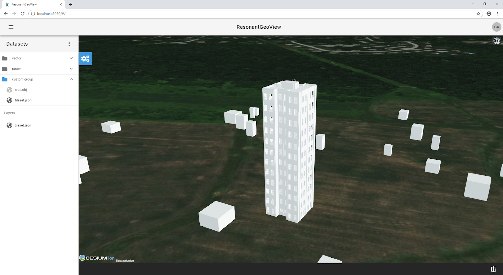
- Visualization of Point Cloud Data with or without Geospatial Context: ResonantGeoView supports Kitware visualization tools VTK and GeoJS but also support third party open source tools such as Cesium. With these state-of-the-art tools supporting ResontGeoView visualization, it is possible to visualize point cloud data in the browser (large or small) with or without geospatial context either for verification or input selection for a particular machine learning algorithm.
Technical Details
ResonantGeoView supports a variety of data types including GeoJSON, GeoTIFF, NetCDF geospatial data, OBJ, 3D Tiles 3D models, and WMS, TMS map tile data. It is built upon Kitware’s open source projects, including GeoJS, VTK.js, Girder, large image, Gaia, Girder Worker and external open source projects including Vue.js, Cesium.js, and GDAL.
Key Features
A unified extensible web application
ResonantGeoView utilizes state of the art web technology such as WebGL to enable hardware enabled 2D or 3D rendering of data in the browser. The user interface is designed with the material design UI/UX concept in mind, enabling an easy to navigate interface while providing advanced customizability.
An open source solution
ResonantGeoView is built as an open source solution and relies exclusively on open source projects. It can be freely used and deployed in any environment.
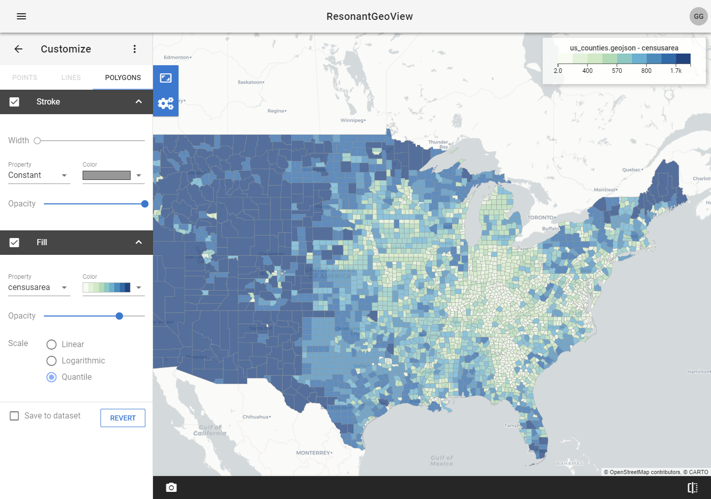
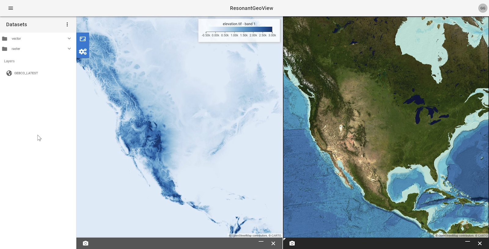
Custom visualization
Vector and raster geospatial data can be visualized with advanced customization to show the interrelationship between datasets in a layered map, or side by side. Visualization results can be saved as image files to local disk for other uses.
Data analysis
ResonantGeoView utilizes Kitware’s proven stack Girder and Girder-Worker to enable data analysis in a scalable distributed fashion. Analyzed result data is imported back into the application for further use or to be downloaded as a local file.
User and permission
Advanced user authentication and permissions are powered by Girder in ResonantGeoView, enabling a multi-user access-controlled environment.
Componentized library
ResonantGeoView internally divides key features into separate components, which makes it possible to use ReosnantGeoView as a library or starting point for other customized web applications.
Easy to Deploy
ResonantGeoView includes Docker scripts to set up the full stack with a few commands. See here for details.
Help and Support
At Kitware, we are experienced at creating new custom solutions and improving existing tools and products to meet end user needs. If you need help with customization or building a product similar to ResonantGeoView using Kitware and other open source geospatial tools, we provide a variety of customer support options. Please check out this link or contact us at support@kitware.com.