IARPA SMART Project Builds on Construction Detection Mission

In satellite imagery, like life, hindsight is 20/20. By looking back at the same spot on earth, you’d be able to easily track the progress of buildings, roads, and construction projects. But what if you wanted to know if a skyscraper or housing development was going up, right now, anywhere in the world?
That’s where Kitware’s IARPA SMART Team comes in. Since 2020, they’ve been working towards teaching AI models to sift through massive amounts of satellite data to find new construction.
Technology
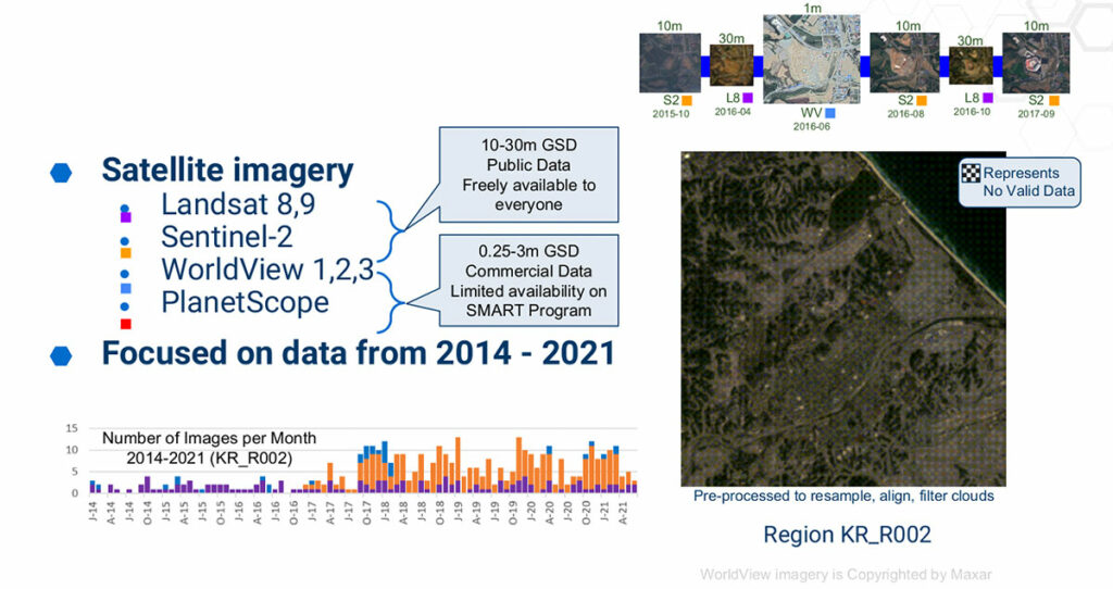
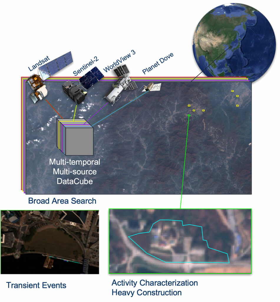
One of the key challenges in this project, and one of Kitware’s two focus areas, is dealing with data from different satellite sources. The team used data from Landsat, a program shared by NASA and the United States Geological Survey; from the European Space Agency’s Sentinel; and from commercial satellite operators Maxar and Planet. And just as you and a friend might argue over whether a passing car is blue or black, the satellites each have their own view of the world. Things like varying spatial resolution, spectral bands, and revisit rates. Beyond that, the team also had to train their algorithm to ignore irrelevant changes like weather, seasons, and other man-made alterations.
The Kitware team focused heavily on what we do best – building a robust, open source software framework. They christened it GeoWATCH. Having a broader framework enables training and deploying geospatial AI models beyond the immediate goals of the program. From there, they focused on model training and algorithm development. By the end of Phase 2 the team exceeded their performance targets in detecting construction.
Environmental Impact
As the work enters Phase 3, the SMART team is focused on finding other uses for the technology. Tracking changes to our natural environment in near real-time. The team said, for example, GeoWATCH could help scientists track man-made deforestation in remote parts of the Amazon rainforest, one of Landsat’s major efforts.
Beyond deforestation, the GeoWATCH team has already adapted the framework for various applications. Things like detecting moving objects in Overhead Persistent Infrared (OPIR) video, and identifying harmful algae blooms in satellite imagery. It’s even helped solve non-geospatial problems, like tracking honey bees in video footage.
The team said they are most excited to see what others can do with the tool. So they have spent much of Phase 3 working to improve GeoWATCH’s documentation and tutorials. These resources will help users understand the full potential of GeoWATCH, fostering a vibrant and engaged community around the platform. And expanding it into uses they never imagined.
By transitioning the technology out of the laboratory and into practical use, Phase 3 will lay the groundwork for GeoWATCH to make a tangible impact on environmental science. The team’s dedication to fostering a collaborative user community, positions GeoWATCH as a powerful tool with immense potential to revolutionize the way many different changes to our Earth are detected and monitored. If you are interested in learning more about this technology or discovering how it can be applied to your project, please contact our team.
This research is based upon work supported in part by the Office of the Director of National Intelligence (ODNI), Intelligence Advanced Research Projects Activity (IARPA), via 2021-201100005. The views and conclusions contained herein are those of the authors and should not be interpreted as necessarily representing the official policies, either expressed or implied, of ODNI, IARPA, or the U.S. Government. The U.S. Government is authorized to reproduce and distribute reprints for governmental purposes notwithstanding any copyright annotation therein.