GEOINT Symposium 2025
May 18-21, 2025 in St. Louis, Missouri
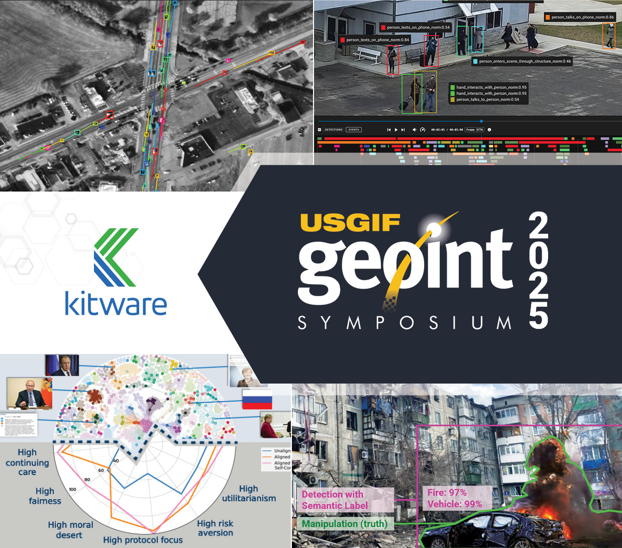
At the USGIF GEOINT Symposium 2025, the world’s premier geospatial intelligence event, Kitware is proud to showcase our latest innovations in AI, computer vision, and interactive visualization that support national security and global awareness. This year’s theme—Building a Secure Tomorrow Together—aligns perfectly with our mission to empower decision-makers through open science and cutting-edge technology.
We invite you to engage with our team at Booth 1922 and attend our lightning talks and training sessions to learn how our open source solutions and AI R&D expertise are helping to solve today’s most pressing geospatial challenges.
Driving Mission Success with Actionable Tools and Deep Expertise
We’re highlighting advancements in generative AI, including our work on DARPA’s In The Moment (ITM) program, where we’ve developed sample-efficient methods to align large language models with human decision-making in high-stakes domains. Our expertise in multimedia integrity assurance continues to support programs defending against AI-generated content, with AI systems capable of detecting synthetic or altered imagery, video, and audio at a level that exceeds human performance.
For organizations handling massive volumes of geospatial data, Kitware provides field-tested, open source platforms such as GeoWATCH and RDWATCH to train, evaluate, and operationalize AI for satellite imagery and other raster sequences. These systems are designed to integrate seamlessly into existing workflows and support rapid decision-making through intuitive web-based interfaces.
We also bring deep expertise in Responsible and Explainable AI—an area critical to building trust in autonomous systems. Our open source Explainable AI Toolkit (XAITK) equips analysts and developers with tools to quantify and visualize how deep learning models make decisions. This supports mission needs in autonomy, image classification, and human-machine teaming, and enables the deployment of AI systems that are transparent, auditable, and trustworthy.
Kitware’s 3D vision capabilities will also be on display. Our open source TeleSculptor platform transforms aerial imagery and video into high-fidelity 3D models using structure-from-motion techniques. Designed to work with or without metadata, TeleSculptor enables analysts to perform geospatial 3D reconstruction even in constrained or degraded data environments—supporting situational awareness, object detection, and mission planning.
Kitware’s technologies are developed in close partnership with government sponsors and delivered as open source to promote transparency, interoperability, and long-term sustainability. Stop by Booth 1922 for a hands-on look at our software and speak with our technical experts about how we can support your mission.
Kitware Training Sessions and Lightning Talks
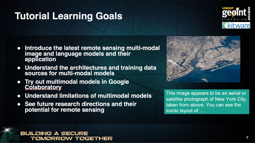
Accelerating GEOINT through Vision and Language Models
Training Session | Monday, May 19 from 7:30-8:30 AM
Presenter: Brian Clipp, Ph.D.
Large vision-language models (VLMs) are reshaping GEOINT by enabling tasks like visual question answering, segmentation, tracking, and small object detection without massive datasets. This training highlights the latest research and open source tools for applying VLMs to remote sensing, with practical demos that show what’s working now. Attendees will also explore VLM-guided compositional programming techniques—breaking down analyst queries into interpretable components and delivering explainable results using existing computer vision tools.
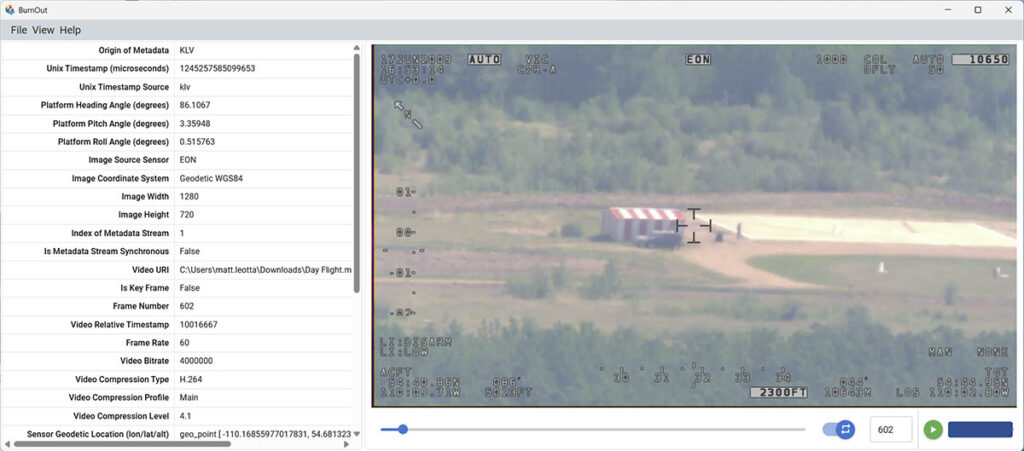
Training Session | Wednesday, May 21 from 7:30-8:30 AM
Presenter: Matt Leotta, Ph.D.
Accurate FMV analysis depends on metadata—but decoding standards like MISB KLV can be challenging without the right tools. This training introduces complete, open source implementations for decoding and encoding FMV metadata, including support for standards 0104, 0601, and MIMD. We’ll address common issues like synchronization, corruption, and missing data, and share practical solutions. Attendees will also learn how to recover metadata using AI-based OCR when KLV is unavailable—empowering analysts with reliable, standards-compliant workflows.
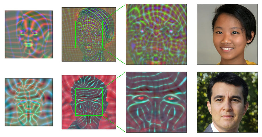
Detecting Images Generated by AI Models
Lightning Talk | Monday, May 19 from 1:50-1:55 PM
Presenter: Anthony Hoogs, Ph.D.
As AI-generated imagery becomes a powerful tool for disinformation, detecting synthetic content is critical. In this talk, we share Kitware’s work under DARPA’s SemaFor program to build a high-performing detector for AI-generated images—including diffusion model outputs—without relying on synthetic training data. Our approach enables effective detection even under strict data provenance constraints. We’ll present qualitative and quantitative results, including performance in overhead imagery, and highlight how this research supports missions where authenticity and trust in visual data are paramount.
Final Kitware Outcomes on the IARPA SMART Program
Lightning Talk | Tuesday, May 20 from 3:30-3:35 PM
Presenter: Matt Leotta, Ph.D.
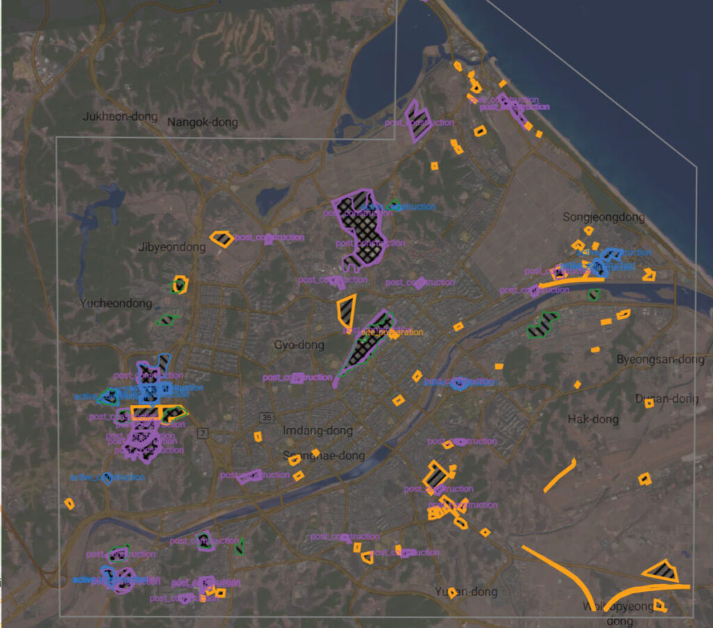
As a lead performer in the IARPA SMART program, Kitware developed GeoWATCH, an open source system for detecting and characterizing man-made change in satellite imagery over time. Our AI-driven solution, deployed on AWS, analyzed data from sources like Landsat and PlanetScope to identify construction activity and track its progression. We also created RDWATCH, a web-based interface for visualizing results. This talk highlights final outcomes from the four-year program, transition-focused improvements, and the open source tools now available for community use in large-scale geospatial change detection.
Computer Vision and AI at Kitware
Kitware is a leader in leveraging artificial intelligence and machine learning for computer vision. Our technical areas of focus include:
- AI Test, Evaluation, and Assurance
- Generative AI
- Interactive AI and Human-Machine Teaming
- Responsible and Explainable AI
- 3D Reconstruction & Photogrammetry
- Multimedia Integrity Assurance
- Activity & Threat Detection
- Object Detection, Classification, & Tracking
- Cyber-Physical Systems
- Data Annotation & Curation
- Edge Computing
- Geospatial Analytics & Remote Sensing
- Semantic Segmentation
- Super Resolution
Kitware’s commitment to continuous exploration and participation in other research and development areas is unwavering. We are always ready to apply our technologies and tools across all domains, from undersea to space, to meet our customers’ needs.
We recognize the value of leveraging our advanced computer vision and deep learning capabilities to support academia, industry, and the DoD and intelligence communities. We work with various government agencies, such as the Defense Advanced Research Project Agency (DARPA), Air Force Research Laboratory (AFRL), the Office of Naval Research (ONR), Intelligence Advanced Research Projects Activity (IARPA), the National Geospatial Intelligence Agency (NGA), U.S. Army and the U.S. Air Force. We also partner with prestigious academic institutions on government contracts.
Kitware can help you solve your challenging computer vision problems using our software R&D expertise. Contact our team to learn more about how we can partner with you.