- Webinar
- March 25, 2026
- 12-1pm ET
Urban Infrastructure Risk Analysis with GeoDatalytics
An overview of GeoDatalytics capabilities for simulating, visualizing, and analyzing risks to urban environments.
Speakers


Prestigious Collaborators

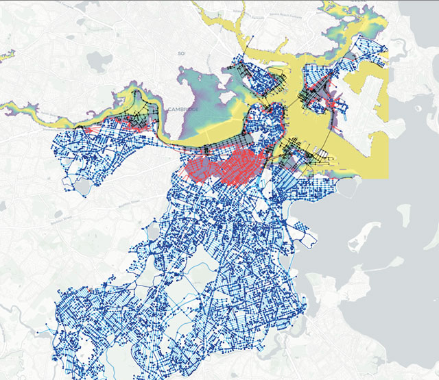
Urban infrastructure systems, such as transportation networks, are increasingly vulnerable to extreme weather events, aging infrastructure, and growing urban demand. Understanding how these pressures affect interconnected systems is critical for cities and infrastructure operators working to improve resilience and planning outcomes.
In this webinar, we will introduce GeoDatalytics, an open source tool developed through a collaborative effort between Kitware and Northeastern University. GeoDatalytics helps teams organize complex urban datasets, explore what-if scenarios, and analyze how disruptions can impact infrastructure systems across a city.
Through a live demonstration, we will show how GeoDatalytics enables users to bring fragmented data together and apply simulation and geospatial analytics to better understand urban infrastructure risk.
In this webinar, we’ll demonstrate:
- Project and dataset management workflows within GeoDatalytics.
- Interactive geospatial visualizations for exploring urban infrastructure systems.
- An AI-driven flood simulation using the GeoDatalytics analytics workflow.
- Transportation network analysis to evaluate how simulated flooding disrupts mobility.
- Integrated visualization techniques to understand cascading infrastructure impacts.
You’ll also hear directly from the GeoDatalytics development team about the project’s goals, current capabilities, and future direction, with time reserved for live Q&A.
Key Takeaways
- Understand how GeoDatalytics supports scenario-based analysis of urban infrastructure risk.
- See how AI-driven flood simulations can be combined with transportation network analysis.
- Learn how geospatial visualization can reveal vulnerabilities and cascading failures in urban systems.
- Ask questions and engage directly with the GeoDatalytics development team.